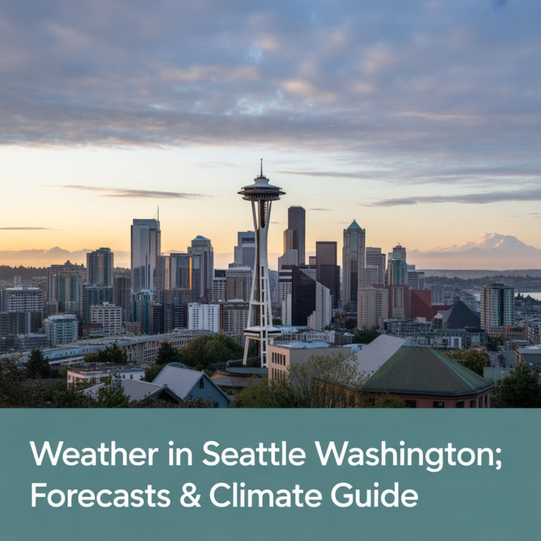
Is It Snowing in Seattle Right Now? Live Tracker & Local Forecast
Wondering, is it snowing in Seattle right now? As someone who has commuted Seattle’s hills during snow for over a decade, I know you need more than just a forecast; you need context. This page combines the latest live data with actionable, neighborhood-specific advice you won’t find on generic weather apps.
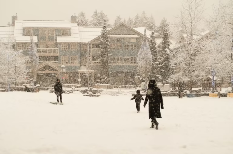
I still remember the Snowmageddon of February 2019. I watched confident drivers try to navigate the seemingly gentle slope of Denny Way, only to slide backward into a slow-motion bumper car session. That week taught me that in the Pacific Northwest, a 30% chance of snow can mean anything from a light dusting on the rooftops of Queen Anne to a city-wide shutdown that leaves us housebound for days.
The reality of Seattle weather is that it is hyper-local. It might be raining in Ballard, dry in Downtown, and dumping three inches of slush on Capitol Hill. While generic weather apps give you a single icon for the whole city, this hub breaks it down using real-time data and local experience.
We aggregate the best live data available, but for critical safety decisions, always verify with official sources like the National Weather Service (NWS) Seattle and the Seattle Department of Transportation (SDOT).
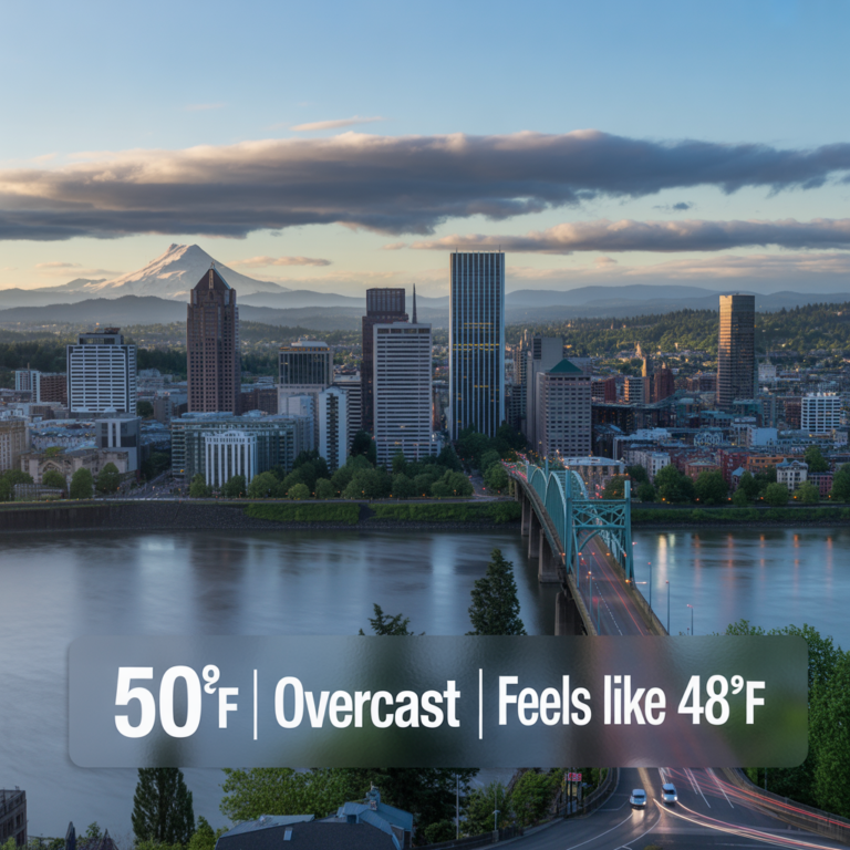
Live Status: Is It Snowing in Seattle Right Now?
To get an immediate answer, we look at more than just the temperature. We look at the convergence of radar, ground reports, and traffic cameras.
Interactive Seattle Weather Map
This live map from Windy.com shows current wind, precipitation, and temperature layers. Use the controls on the map to toggle different views.
Key Live Metrics to Watch
Temperature at Sea-Tac vs. Your Hill
Most apps pull temperature data from Sea-Tac Airport, which is at a different elevation and distance from the water than many Seattle neighborhoods. Elevation matters more than distance here. If Sea-Tac reads 36°F, it could easily be 32°F and snowing on top of Queen Anne or West Seattle. When checking the temperature, always subtract 2-3 degrees if you live above 300 feet.
Precipitation Radar Loop
Look at the radar loop above. Green usually indicates rain, while blue or pink indicates snow or a wintry mix. However, in Seattle, the air is often dry near the surface. This causes virga snow that shows up on radar but evaporates before it hits the ground. If the radar is blue but nothing is falling, give it an hour; as the air saturates, that snow will eventually reach street level.
Traffic Cam Check
The most reliable eyes on the ground are the WSDOT and SDOT traffic cameras. I highly recommend checking cameras on high-elevation routes.
- First-Hand Experience Tip: If you see slush accumulating on the Elliott Bay Bridge cams or the West Seattle Bridge, it is likely already sticking in neighborhoods like Ballard, Magnolia, and Maple Leaf.
The Seattle Snow Vibe Check
Current Status as of Today:
Condition: Standard Pacific Northwest Grey.
Roads: Clear and wet.
School Outlook: Normal schedule.
Local Take: No immediate snow accumulation is expected in the metro area below 500ft.
Seattle Snow Forecast: Next 24-72 Hours Explained
Forecasting snow in the Puget Sound region is notoriously difficult due to our proximity to the ocean and the mountains. A shift of 20 miles in the low-pressure center can be the difference between a rainy Tuesday and a snow day.
The Short-Term Outlook (Tonight & Tomorrow)
Currently, models are watching for the formation of a Puget Sound Convergence Zone. This phenomenon occurs when air flows around the Olympic Mountains and collides over Puget Sound, forcing the air upward. If temperatures are marginal (34°F-36°F), this upward motion cools the air dynamically, turning rain into heavy wet snow in a narrow band often right over North Seattle and Lynnwood, while areas just south see nothing but rain.
The 3-Day Snow Risk Outlook
| Day | Snow Accumulation Potential | Biggest Impact |
| Today | Low (< 10%) | Evening Commute (Rain/Slick Roads) |
| Tomorrow | Moderate (30-40%) | Morning School Delays, North Seattle |
| Day 3 | High (> 60%) | Potential City-Wide Transit Disruptions |
Why Seattle Forecasts Change Fast: A Local’s Explanation
You might wonder why the forecast changes every few hours. It usually comes down to the Rain Shadow and the source of the cold air. For us to get significant snow, we need cold air from the Fraser River Valley in British Columbia to filter down before moisture arrives off the Pacific. If the moisture arrives first, it washes away the cold air. If the cold air arrives late, the moisture is already gone. It is a delicate timing act that models often struggle to pin down until the event happens.
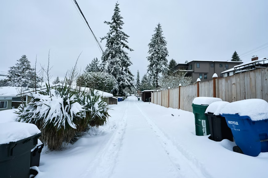
Seattle Snowfall by Neighborhood: Where It Sticks
| Impact Level | Neighborhood Examples | Key Factor |
|---|---|---|
| High Impact | Queen Anne, Capitol Hill, West Seattle (High Point) | Higher elevation (300-500+ ft) |
| Moderate Impact | Ballard, Fremont, Central District | Lower elevation, convergence zone bands |
| Low Impact | Downtown, Belltown, South Lake Union | Sea level, urban heat island effect |
Does Seattle get snow evenly? Absolutely not. Neighborhoods in Seattle have distinct microclimates based on elevation and proximity to the Sound.
High Impact Areas
West Seattle (High Point), Queen Anne, Capitol Hill, Magnolia, Maple Leaf.
These neighborhoods sit at higher elevations (300-500+ feet). During marginal events where the temperature is hovering around 34°F, these areas will often see 1-3 inches of slushy accumulation while downtown sees only rain. If you live here, assume road conditions will be worse than the general forecast.
Moderate Impact Areas
Central District, Ballard, Fremont, Green Lake.
These areas are lower but not at sea level. They are susceptible to the Convergence Zone bands. Snow often melts on contact with the road initially, but can freeze overnight into cobblestone ice, which makes side streets treacherous.
Lower Impact Areas
Downtown, Belltown, South Lake Union.
The Urban Heat Island effect, combined with sea-level elevation, keeps these areas warmer. It rarely sticks on the roads here unless we are in a deep freeze event (temperatures in the 20s).
Will Seattle Schools Have a Snow Day Tomorrow?
Parents know the anxiety of refreshing the district website at 5:00 AM. Here is how to predict the call before the text comes in.
How District Decisions Are Really Made
School districts like Seattle Public Schools usually send transportation scouts out around 3:00 AM to drive key bus routes, particularly on the hills. If buses cannot safely navigate the steep grades of Queen Anne or West Seattle, the whole district often shuts down or is delayed, even if schools in flatter areas are accessible. They prioritize the safety of the most difficult route.
Our Snow Day Likelihood Analysis
Use this checklist to gauge your chances of a pajama day:
- Is the overnight low forecast to be below 28°F? (Ice risk is higher than snow risk for closures.)
- Is the precipitation forecast to start before 5:00 AM?
- Are neighboring districts (Shoreline, Northshore) already calling delays?
- Verdict: If you answered Yes to at least two, prepare backup childcare.
Navigating Seattle Snow: A Practical Guide
Road Conditions & Travel: What You Need to Know
If you don’t have to drive, don’t. Seattle drivers are generally inexperienced in snow, and the city does not salt side streets aggressively due to environmental concerns for the Puget Sound.
- Check the Maps: Always view the SDOT Storm Response Map to see which arterials have been treated.
- The Kitty Litter Trick: Keep a bag of cheap, non-clumping kitty litter in your trunk. If you get stuck on a patch of ice, pouring litter under your drive tires provides instant traction.
- Bus Routes: Metro buses will shift to Snow Routes. This usually means they skip steep hills. Know your snow route stop before you leave the house.
Home & Safety Checklist for a Seattle Cold Snap
Our snow is heavy and wet (often called “Seattle Cement”). This creates different risks than the fluffy snow found in the Midwest.
- Protect Faucets: Disconnect garden hoses and cover outdoor faucets. Our homes aren’t insulated for sub-freezing temps, and burst pipes are common.
- Clear Gutters: Heavy wet snow can freeze in clogged gutters, causing ice dams that force water backward into your roof and walls.
- Power Outages: The weight of the snow often snaps tree branches onto power lines. Have flashlights and power banks charged.
Deep Dive: Understanding Seattle’s Unique Snow
Why Is Snow in Seattle So Rare (and Chaotic)?
Seattle sits in a temperate marine climate zone. The Pacific Ocean acts as a giant radiator, keeping our winters relatively mild. For us to get snow, we need a perfect storm: cold Arctic air forcing its way south from Canada, meeting moisture streaming off the relatively warm ocean. This combination is rare. According to NOAA, Seattle averages only about 6 inches of snow a year, but it usually comes all at once, paralyzing a city built on steep gradients.
Historical Seattle Snow Events & What They Teach Us
- 2008: The year nearly everyone abandoned their cars on the roads. It taught the city the importance of pre-treating roads.
- 2019 (Snowmageddon): We saw over 20 inches in February. It proved that, despite our mild reputation, Seattle can be severely impacted, and having a 14-day supply of food isn’t an overreaction.
Conclusion
Whether you are hoping for a snow day or dreading the commute, navigating Seattle winter requires reliable data. By combining the live tracker on this page with an understanding of our unique microclimates, you can make more informed decisions about when to travel and when to stay put.
Bookmark this page for winter. For the absolute latest official alerts, follow the National Weather Service Seattle.
Sources
- Windy.com Interactive Weather Map
- National Weather Service Seattle
- Seattle Department of Transportation (SDOT)
- NOAA Climate Data